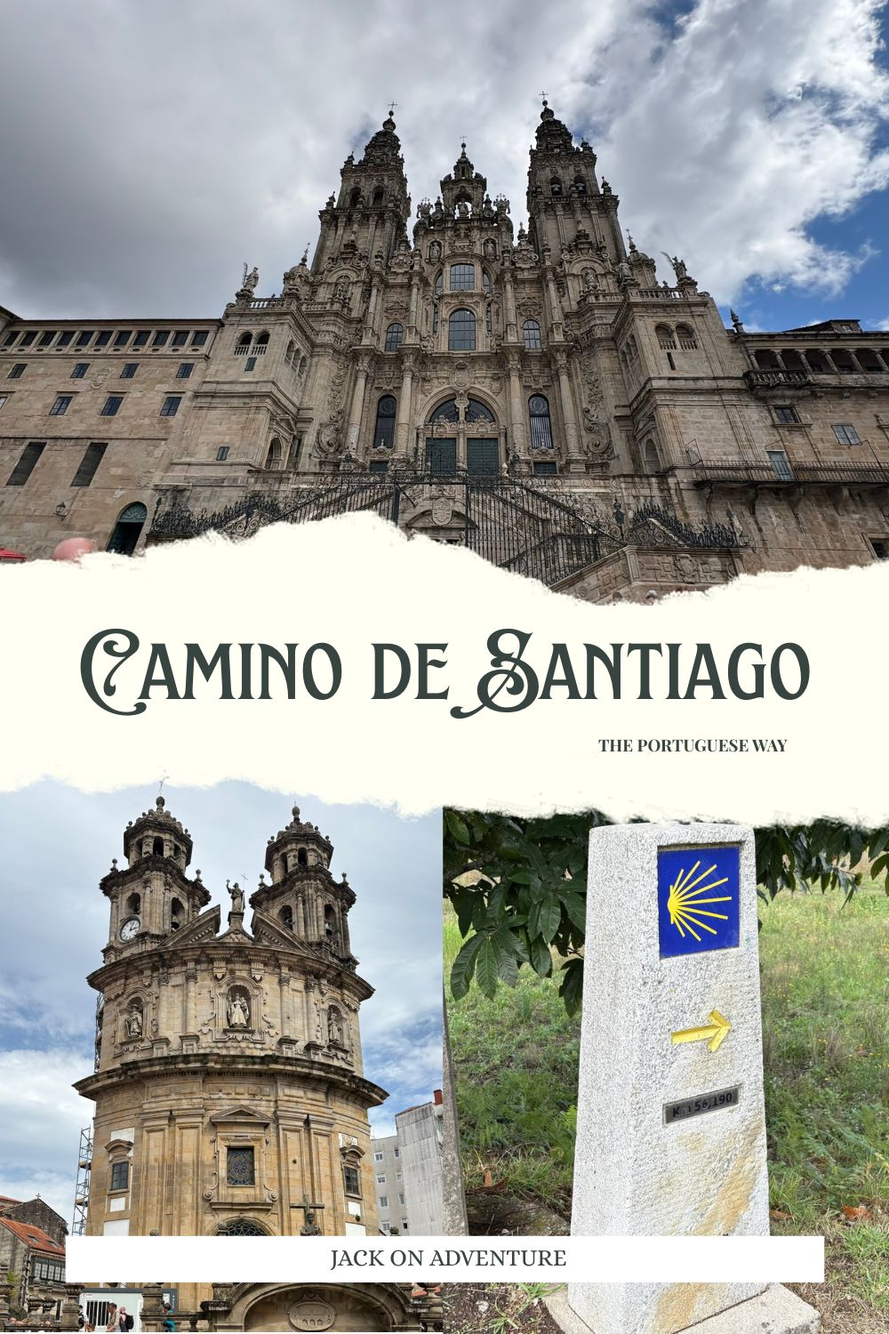
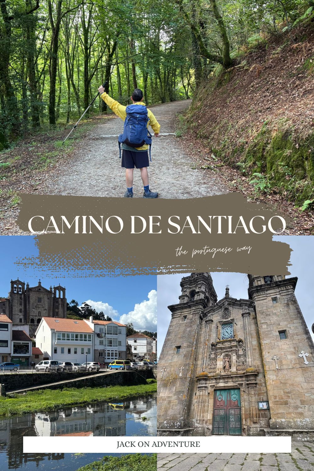
The Camino de Santiago is arguably the most significant and historic Christian pilgrimage in the world. Dating back to the 9th century, millions of people have embarked on the journey to Santiago de Compostela after the discovery of Saint James’ remains.
The Camino Portugués Coastal route is one of many trails that pilgrims walk to visit the Cathedral of Santiago de Compostela. The remains of Saint James is found inside the impressive Cathedral. Many people still walk the Camino for religious reasons to see Saint James’s remains and visit the churches and other religious sites along the way. However, since the 21st century, people from all walks of life in every corner of the world take this unforgettable journey as a pursuit of personal growth, cultural exploration and physical challenge.
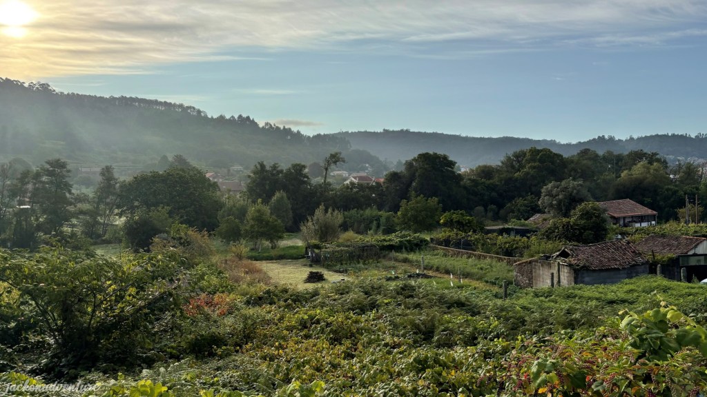
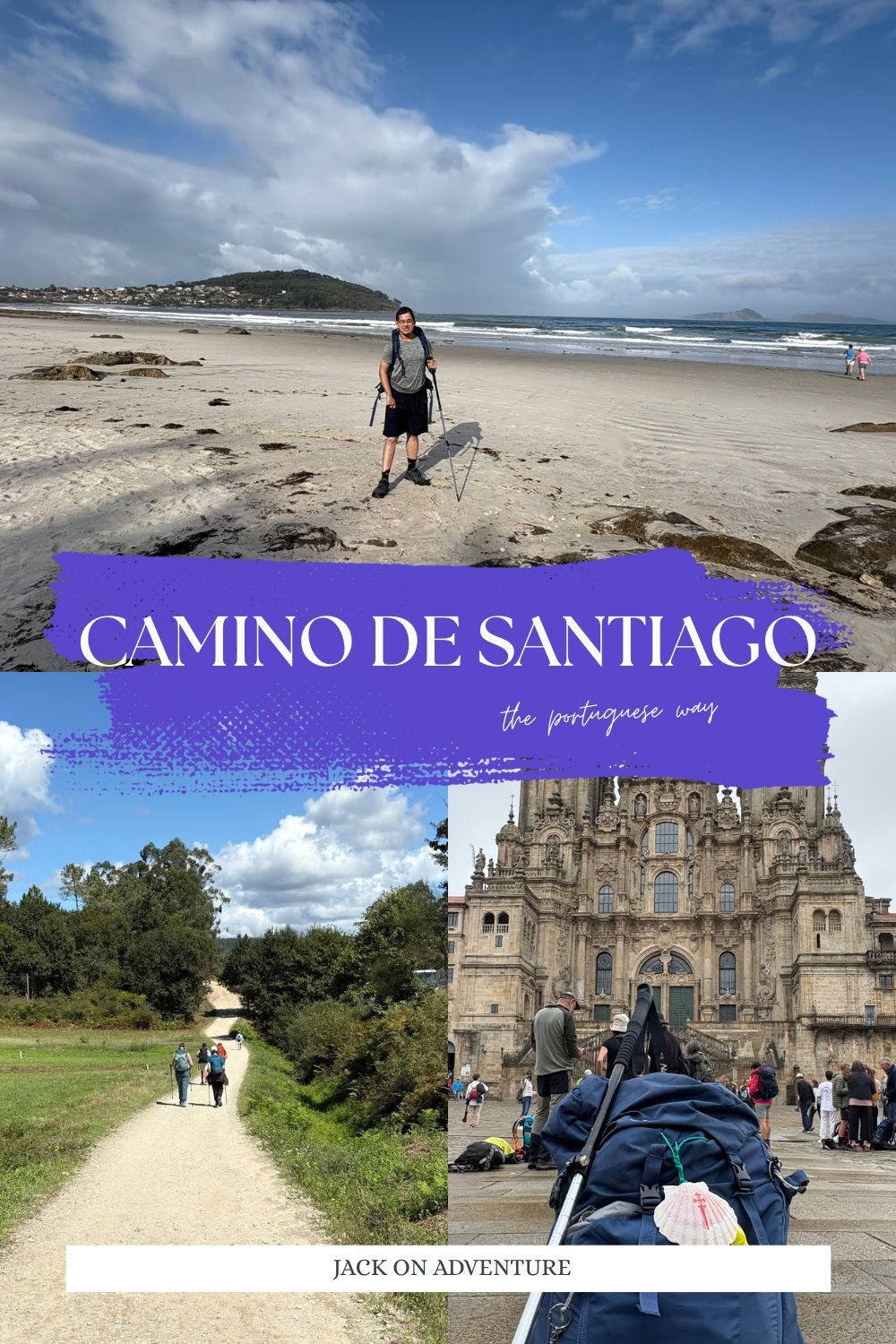
In September 2025, I embarked on my first and solo Camino journey along the Camino Portugués (The Portuguese Way) on the Coastal Route. I personally didn’t hike the Camino for any religious reasons, but wanted to embrace that part of myself and take part in this incredible adventure like so many before me. My journey along the Camino Portugués Coastal Route brought me to breathtaking beaches, charming churches and chapels, lush green forests and wonderful hospitality.
Honestly, walking the Camino is not as easy as it looks. Not only do I need to be physically ready, but also mentally prepared to tackle many obstacles along the trails. Thanks to the help of other pilgrims and the Camino community, I’m truly grateful for successfully completing the 119-kilometer trail to Santiago de Compostela in a week.
Camino Portugués Coastal Route Overview
For those who love ocean views, the Camino Portugués Coastal route is a great experience that offers stunning views of pristine beaches and blue ocean if compared to the Portugués Central or the Camino Francés. This route is the second most popular Camino route to Santiago.
Some people start the journey from Porto, Portugal, which covers a length of 274 kilometers. It takes at least 12 days to complete, depending on each individual’s daily walking distances. Others will skip the coastal area and choose the shorter route, where they begin from Tui or Vigo (the last 100 kilometers to Santiago to qualify for the certificate of completion).
Personally, I set off on my Camino walk from a small Nigran town that is located about 17 kilometers from Vigo city. The length of the walk is 119 kilometers, which makes me eligible for the certificate. I still have the opportunity to walk along the beautiful coast on the first day.
Getting There
How to Get to Porto
As the second-largest city in Portugal, Porto is reachable by flight from Lisbon and other parts of Europe. If you’ve a cheaper option, you can fly to Lisbon and take a direct bus from Lisbon Oriente Bus Terminal to Porto. Bus operators running this route include Alsa, Flixbus and Rede Expressos.
How to Get to Vigo
If you’re walking the last 100 kilometers of the Camino, the starting point will begin from the renowned Vigo City. There are limited direct buses to the city. The best option is to take a bus from Lisbon Oriente Bus Terminal to Braga or Porto, then transfer to another bus to Vigo. Alsa, Flixbus and Rede Expressos also run on this route.
How to Get to Nigrán
If you want to walk just a small part of the Coastal route, you can follow the same bus route to Vigo. From the city, take a taxi from the Vigo Bus Terminal to reach Nigrán, which is located about 17.5 kilometers from Vigo.
Before starting on my Camino, I took the Flixbus from Lisbon Oriente Bus Terminal to Braga City and got onto another bus to Vigo. The journey takes around 7.5 hours, including transit time. The ride costs €19 (September 2025) and the journey went smoothly. Then, I took a taxi outside the terminal’s shopping mall and arrived at the hotel in Nigrán within 30 minutes.
Where to Get Your Camino Passport
If you’re researching about Camino de Santiago, you often hear a lot about the Pilgrim Credential. But what exactly is the credential for?
Known as the ‘Credencial’, the pilgrim passport is essential for the Camino de Santiago, serves as a record of the journey and proof of the pilgrimage. This document qualifies you to collect a Compostela certificate from the pilgrim office in Santiago de Compostela, as long as you’ve walked the last 100 km or cycled the last 200 km of the Camino. Stamps can be collected along your journey at accommodations, cafés, churches and town halls.
The pilgrim passport also identifies you as a pilgrim, which allows you to stay in many albergues, known as pilgrim hostels. You can also get a stamp for your credential in these alberques.
The Pilgrim Credencials can be obtained along the Camino Portugués from Sé Cathedral or The Lisbon Friends of the Camino group in Lisbon; Porto Cathedral or the Pilgrim’s Reception Office in Porto; or Establecimientos Jamaica Vigo on Praza da Pedra, Vigo.
Have Extra Baggage on Hand?
You have several choices when it comes to dealing with extra baggage before your Portuguese Coastal Camino. I recommend Correos service if you want the postman to pick up the baggage from one accommodation in the morning and have it sent to the next accommodation by afternoon. Correos operates throughout Spain and it is the best option for hikers who are walking the last 100 kilometers or anywhere around the country.
This Spanish Postal Service makes the process really easy. I coordinate everything with the staff via email, and they answer all my enquiries within 24 hours. They allowed travelers to send their baggage weighing up to 15 kg per bag and cost €4 per trip within a 60-kilometer distance. You can also request to send the baggage directly to the office in Santiago to be stored, and they charge €4 storage fee per day.
Other baggage transfer providers include Caminofácil, Pilbeo, TopSantiago and Tuitrans. These companies offer baggage transfer service along the Camino Portugués Coastal and Central routes.
Pre-Start: Lisbon – Nigran
Traveling 17 hours halfway across the world, I have arrived in Lisbon and spent 2 nights in the beautiful city. I decided to stay in Lisbon before continuing my journey to my starting point, so I could adjust to a different time difference and overcome the jet lag.
The next day, I went to explore the city center and make a visit to the stunning Sé de Lisboa, known as the Lisbon Cathedral. It’s here that I received my first official stamp for my credential with the “Dual Pilgrim”. Another reason I walk the Way of St James is to earn a “Dual Pilgrim” certificate. To be certified as a “Dual Pilgrim”, a pilgrim or hiker needs to complete the pilgrimage walk on Camino de Santiago and and Kumano Kodo in Japan. I had finished the Kumano Kodo trail in the summer of 5th July 2024.
I also took a glance of the white-walled Church of St James while walking down the hilly street from the cathedral. It was dedicated to St James and is the starting point of the Portuguese Way for pilgrims. Most pilgrims, including myself, will begin either from Porto in Portugal (259 km) or Vigo in Spain (100 km).
After having sufficient rest, I take the Flixbus ride on the third day from Lisbon Oriente to Vigo with a transfer at Braga. The journey takes about 7.5 hours including a 2-hour stopover. To reach my final destination, I hopped on a taxi from Vigo Bus Terminal to my hotel, El Retiro in Nigrán, where I started my pilgrimage walk the next morning.
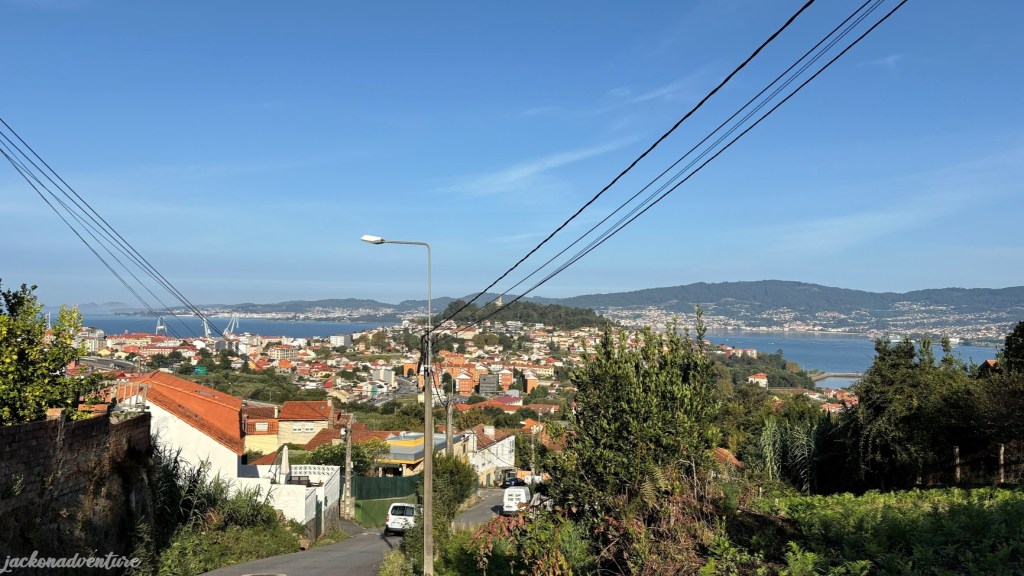
Day 1: Nigran to Vigo (17.6 km)
(Nigran – Patos – Saiáns – Oia – Bouzas – Vigo)
Elevation Gain: 381.18 meters/ Elevation Loss: 370.19 meters
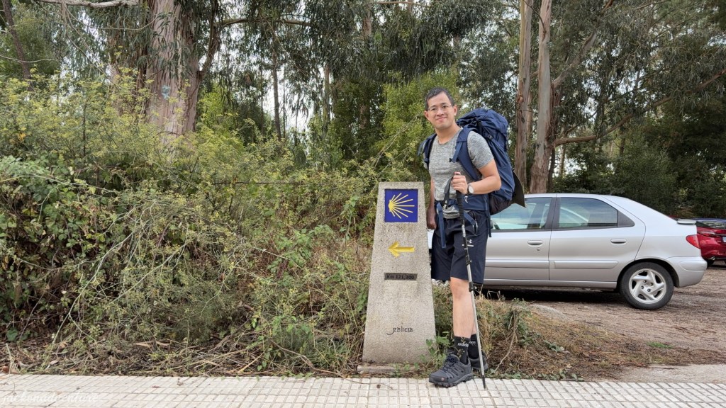
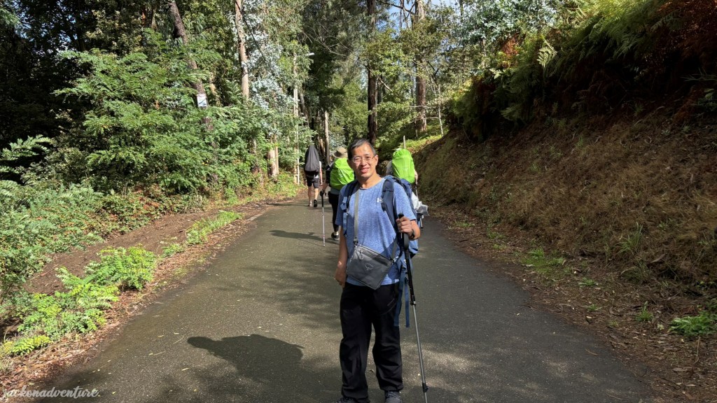
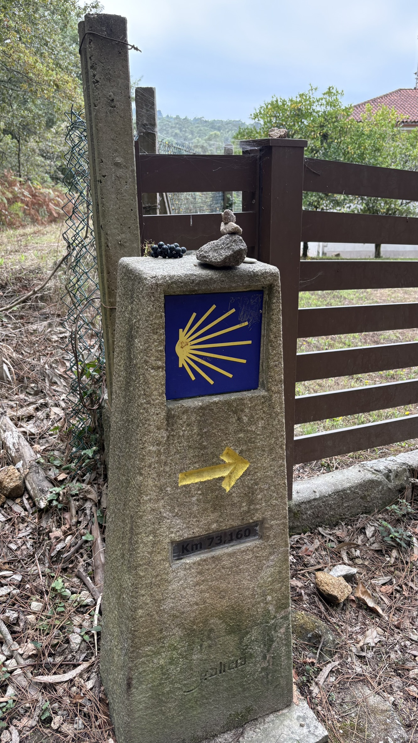
I embarked on the Road to Santiago at 9 am after having some pastries for breakfast from a bakery shop opposite the hotel. There is a stone Camino distance marker near the hotel entrance, which indicates the distance of 121.3 kilometers to Santiago. These solid grey concrete markers are a familiar sight along many Camino routes, often featuring a yellow arrow, a scallop shell and the remaining distance to Santiago.
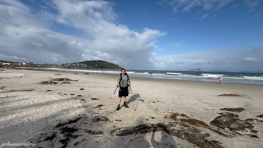
Although the yellow arrow pointed to the left, my journey lies in another direction, where the road leads to the Coastal Route of the Camino Portugués. It passes through a modern residential area to the beautiful Panxón Beach. I spotted the first couple carrying backpacks and holding hiking poles as a sign of the right path to Santiago.
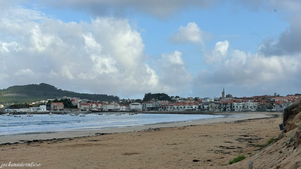
Pilgrims who take the Coastal Route walk through this calm beach. Many walkers began the journey as early as 7 am to take advantage of the morning cooler weather. There are several cafes and pastry shops along the beachfront. The hilltop stands a tall Votive Temple of the Sea, a Gothic-style parish church of San Juan de Panjón.
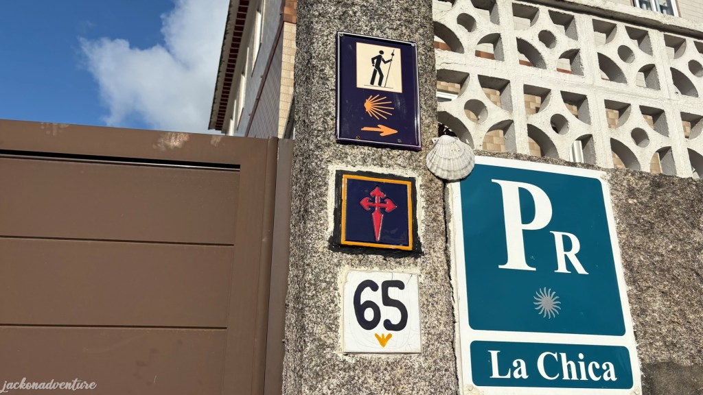
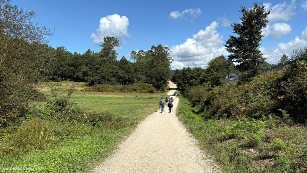
It is easy to find the right path along the Camino route thanks to recognizable scallop shells with the yellow arrow. These shells are also painted or carved on trees, tiles, pavements, posts, walls and granite stones. It helps to guide pilgrims towards Santiago de Compostela. Many locals also offer a helpful hand by showing the right directions in case anyone gets lost during the hike.
The walk along Rua Tomas Mirambell passes through a small Madorra Beach and a small town. The street is lined with some small cafes, taverns and inns. Many walkers take this opportunity to replenish their food and water supplies, have their brunch and refresh themselves.
I took a short break on the less crowded Praia de Patos, the southernmost of the Rías Baixas. The pristine sandy beach offers stunning views of the Cíes Islands. The peaceful atmosphere calms my mind as I enjoy the sound of the ocean waves.
Then, I continued my journey with a small uphill onto Estrada Pola Via along PO-325, where I met a couple in their late 60s, Bob and Jenny Chaplin from Georgia, US, who began the walk from Baiona. We stopped by a small tavern to have small drinks while I had an energy bar that I brought from home.
Before leaving the bar, I asked the bar owner if he had any scallop shells. I felt glad as he kindly offered a scallop shell for free, although it doesn’t come with a symbol. I temporarily hang it on the back of my backpack until I find a replacement. Jenny was willing to look for the symbolized shell for me when we see each other again.
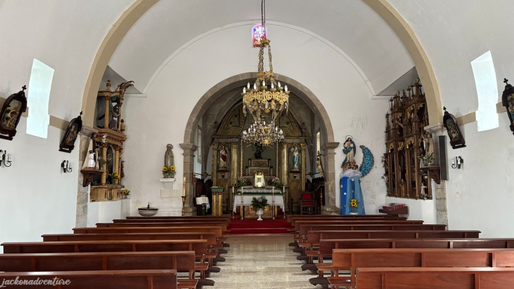
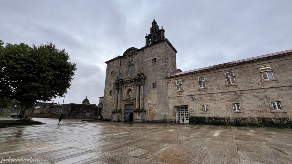
By noon, I took a detour to visit Igrexa de San Miguel de Oia. I walked along Av Ricardo Mella on PO-325 until a roundabout and turned right onto Camino Senra de Abaixo street. The church is pretty small and only spent 15 minutes to visit.
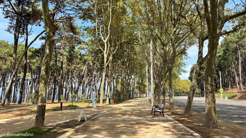
Turning right and walk less than 1 kilometer to the PO-324 and find a small Playa del Vao and Praia da Fontaíña. Later, the path crosses a short bridge to a long stretch of Praia Samil. As the weather started to heat up, I walked on the roadway in Avenida de Samil covered by tall trees instead of the beach. There are benches located along the pathway to sit comfortably and take a rest when needed. Both sides of the streets are filled with many international restaurants, hotels and fast-food chain restaurants.
Later, I found myself strolling along the seaside neighborhood of Bouzas. Its cobbled streets give me the sense of traveling back in time as I take a quick exploration of the Old Town that is surrounded by well-preserved historic buildings. There is a lovely Igrexa de San Miguel de Bouzas, rebuilt in 1697 to accommodate the growing population. Unfortunately, the church wasn’t open when I got there.
After crossing the opposite street from the church, I walked into an area rather dull as the scenic views faded away. There are blocks of offices and shipyards with many cranes and derricks. It doesn’t look like the best place to walk into Vigo, but it gives an interesting sight to see the construction of the ships.
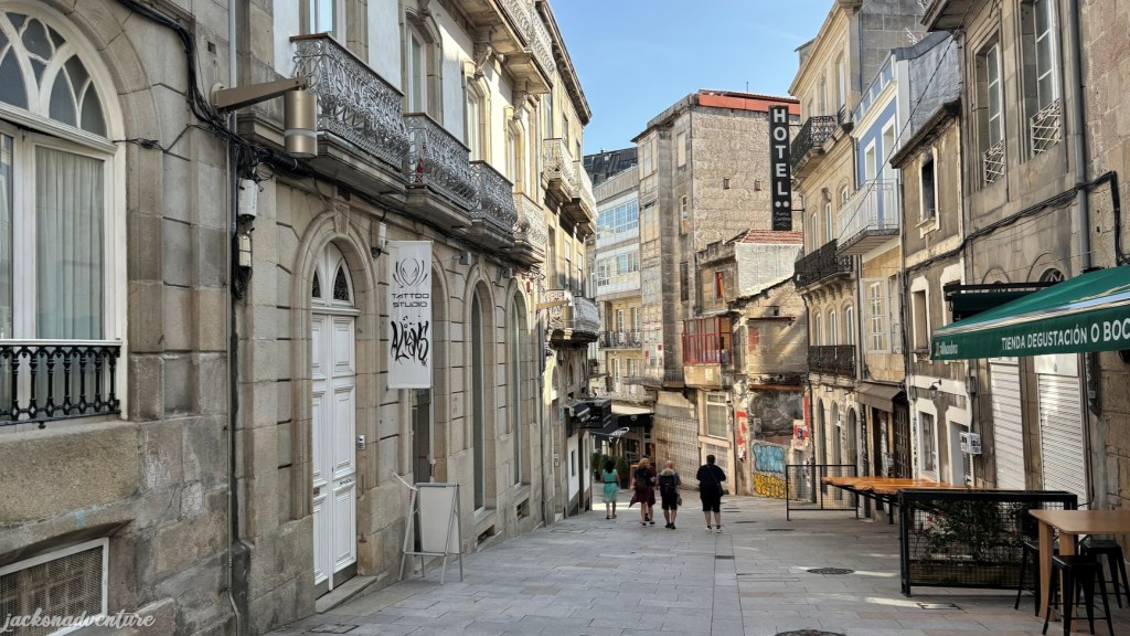
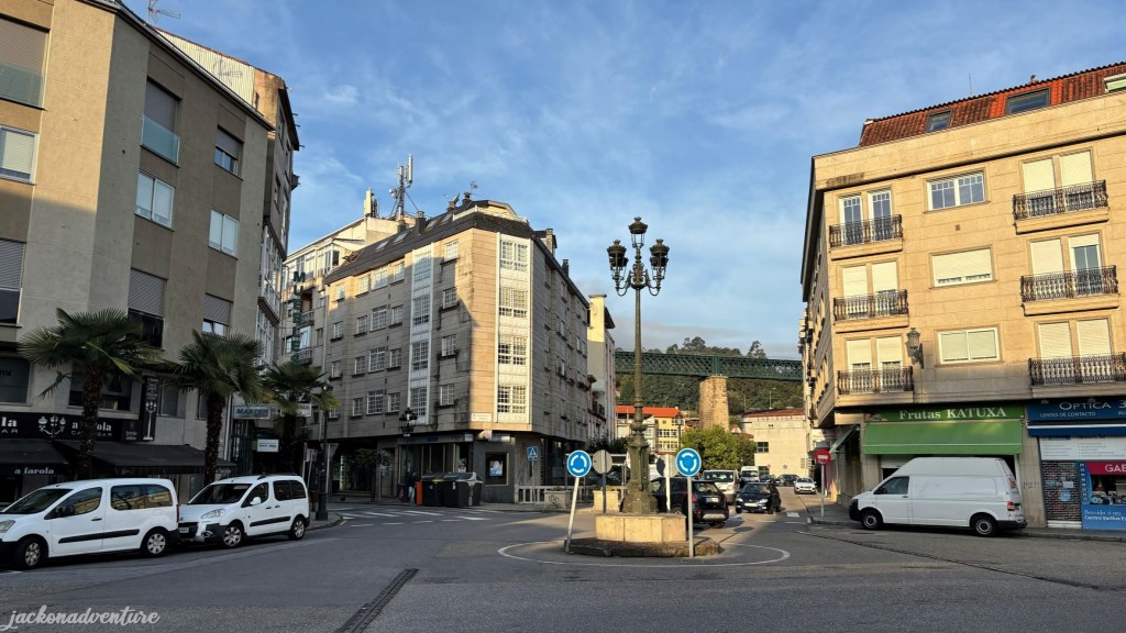
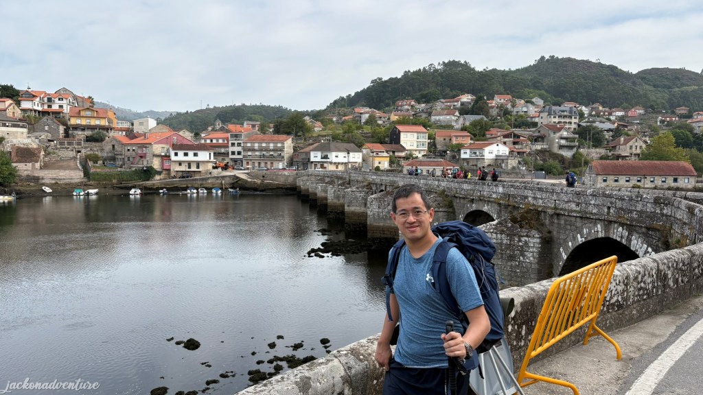
Continue walking for the last 2 kilometers and finally arrive at the city center. Vigo is the largest city in the Galician region with emblematic buildings and a bustling port. It is well-known for its thriving fishing industry and a popular holiday destination for a getaway to some best beaches. The city also serves as the official starting point for the last 100 kilometers to Santiago de Compostela on the Coastal Route.
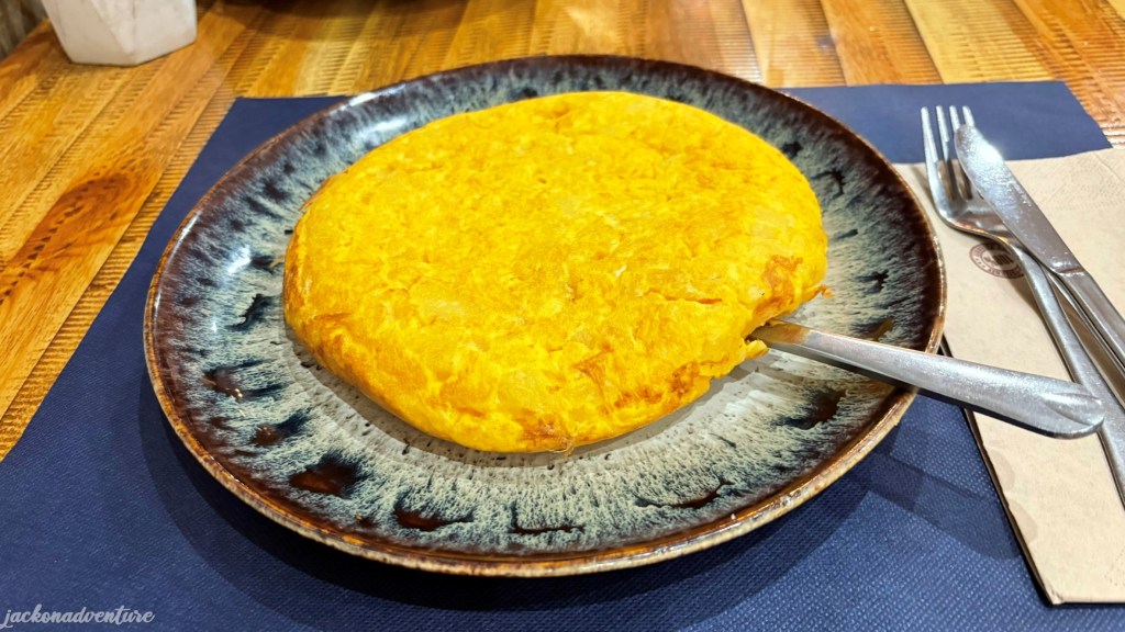
After completing my first day of a 17-kilometer walk, I felt so tired and only rested in my hostel at Hostal Buenos Aires before dinner. There are many restaurants and cafes downstairs. The cozy atmosphere of Lagharto Pintado attracted me to dine in here and the Tortilla Espanola is truly enormous. I thought the serving was the ”tapas’ size and had been ‘warned’ by the staff for not ordering two dishes.
While I enjoy my delicious tortilla, two familiar faces showed up at the restaurant. They were Jenny and Julia from Atlanta, United States, who first met in the tavern near Praia de Patos and near the shipyard in Vigo. Now, here we are again having dinner together and sharing our wonderful first day of the Camino experience.

Day 2: Vigo to Redonlela (16.39 km)
(Vigo – Teis – Rande – Cedeira – Redonlela)
Elevation Gain: 368.23 meters/ Elevation Loss: 385.2 meters
Today is one of the shortest walks of my Camino journey. Still recovering with three blisters on my knee and one toe (Ouch!), I repacked my backpack into another luggage before sending it to my next accommodation in Redonlela with El Camino con Correos.
Finding the Camino trail again, I walked down to Praza de Compostela and passed Vigo Train Station and the shipping container yard. Seeing many pilgrims walking up the gently uphill got me some relief that I’m heading in the right track.
Later, I walked along a long stretch of shophouses in Teis that is filled with many small cafes, supermarkets, boutique stores, gift shops and pharmacies. It is a good time to replenish the blister plasters for the next few days. Many walkers had their breakfast here and got some snacks for today’s long walk.
The road on Avenida de Gallicia leads me to a bridge crossing over the train tracks and the steepest path with 160 meters of elevation to Senda da Auga. At this point, I took a break to admire one last scene of Vigo and bid farewell to the city.
The trail at the hilltop is well-paved and surrounded by modern houses. The steep hill walk is worth the effort, with the breathtaking views of the bay awaiting here. I came across two groups of pilgrims who also travel a long way from the Philippines and Romania. Soon, I stopped by a small cafe and the owner was selling light refreshments and drinks.
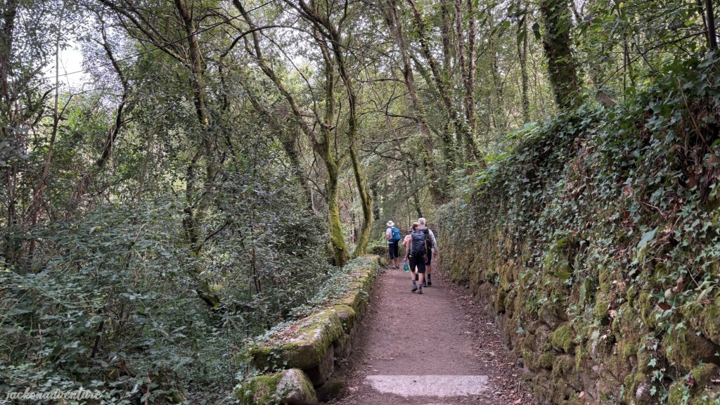
The path to the Senda del Agua, or Trail of the Water emerged, a scenic route on the outskirts of Vigo. It traces the water supply channel from the Eiras reservoir to the city. An information board on the road provides details about the aqueduct’s history and its importance in the 19th century.
This is a wonderful trail and popular among the locals and sometimes encountered cyclists sharing the trail. It offers softer terrain in places, which provides some relief from the tarmac roads and pavements.
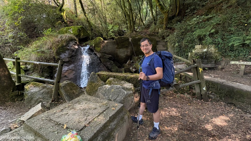
The residential streets give way to the forest again and arrive at the Cascade de Rego Fondón, a small waterfall just on the trail. It’s easy to spot with a small picnic area beside it. There is a wonderful piece of a brightly coloured fish.
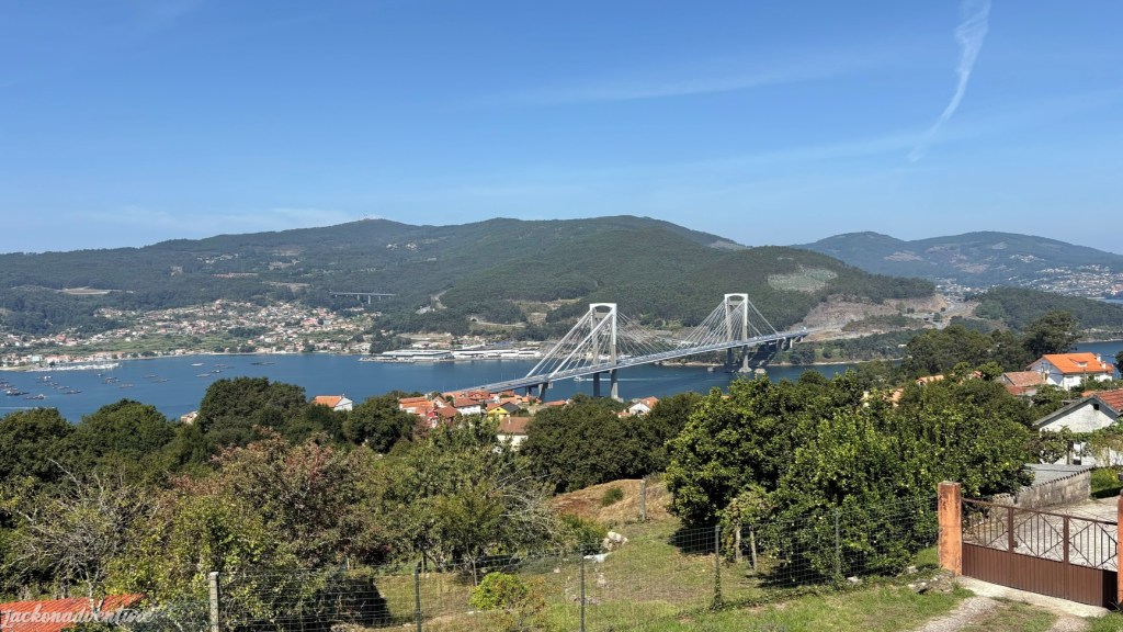
Yet again, the trail brought me back to the road and got rewarded with magnificent views of the Ponte de Rande, an impressive modern engineering. Opened in 1981, the cable-stayed bridge spans the Ria de Vigo with a length of 1,558 meters and 401 meters wide at the central span. Today, about 50,000 vehicles travel on this bridge.
Just less than 200 meters away is a mini store and the lady is selling some light refreshment, fruits, scallop shells and other souvenirs.
Walking under the shady trees for another 1.5 kilometers, I leave the forest trail and make the descent down to Redonlela. The views from the top are breathtaking and I follow a winding tarmac road. My hiking pole comes in handy, giving good support to my knees when going down the steep hill.
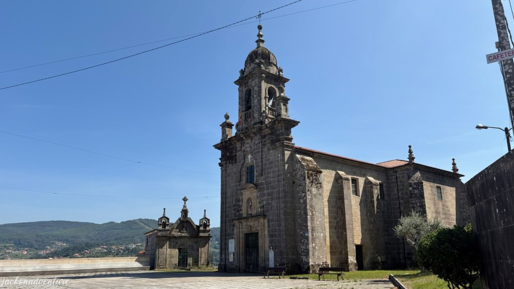
Toward the end of the steep hill is the Iglesia de San Andrés de Cedeira, which was built in 1743. The Baroque church is believed to be built on top of a much older medieval church. Unfortunately, it is closed for visitation, like many churches in Spain.
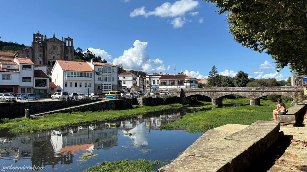
As soon as I reached Redondela, I was greeted by the imposing stone viaducts – the striking symbol of the historic city. It dates back to pre-Roman times and played an important role in the region’s maritime trade during the Middle Ages. The viaducts that run through the town are a testament to its importance in the railway infrastructure development in the 19th century that connect with Vigo and other Galician cities.
I saw some pilgrims approaching from the south of the city as they come from Tui along the Central Route. From here on, people who walk on the Coastal Route will join them to continue the journey to Santiago de Compostela.
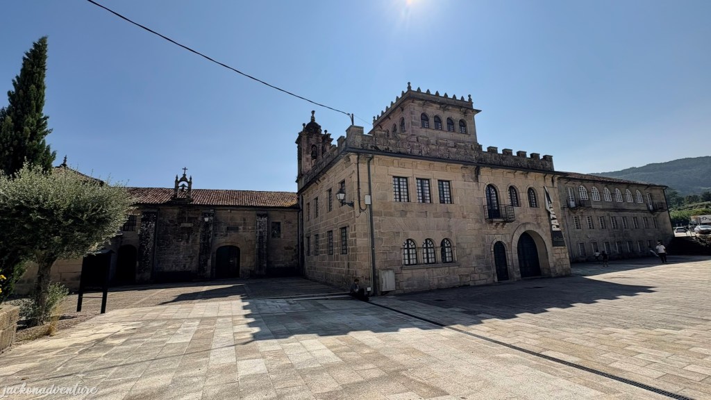
Located at the entrance of the town is the Convento de Vilavella that was founded by the Order of Saint Lawrence Justinian in 1554. The convent has two large stone halls, a cloister and an outdoor areas that provide the perfect natural setting for hosting both civil and religious ceremonies. There is an inscription outside the sacristy that reads: “The monastery was built by Garcia Pergo, archdeacon of Cerbeira”. Above bears the coat of arms of the Prego de Montaos family, who were also responsible for the so-called Casa da Torre, the current pilgrims’ hostel here.
Just a few blocks away is my lovely La Casa de la Abuela where I stayed for a night in Redonlela. The house is located in the heart of the town on the third floor and offers amazing hospitality by the owner, Augusto. I had a treat of the herbal sachet made by the host for a gentler healing to my feet for the recovery from blisters. The ingredients used were created by his grandmother who worked at her own pharmacy store in Redonlela.
Day 3: Redonlela to Pontevedra (19.6 km)
(Redonlela – Arcade – Pontesampaio – Pontevedra)
Elevation Gain: 469.31 meters/ Elevation Loss: 472.76 meters
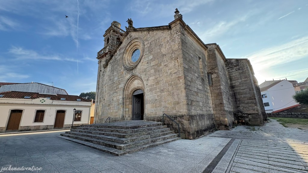
Before leaving the Town of Viaducts, I visited the small Igrexa de Santiago de Rodenlela, just 100 meters from the town’s main roundabout. Consecrated in 1114, the Baroque church is adorned with intricate altars and religious artifacts that reflect the rich spiritual heritage of the region. The sacristy covered with a barrel vault, features the Redondela’s coat of arms with the shells facing upside down.
Knowing my limitation of walking distance each day, I decided to skip one section of the Camino and hailed a taxi. I asked the taxi driver to drop me near Albergue A Filla do Mar, less than a kilometer walk to the center of Arcade town. There is no shame in shortening my walk by 6 kilometers. After all, this is not a competition to complete the race to my distance. It’s better to be safe rather than feel sorry if any injury happens and can’t finish the Camino walk. I saw three ladies who opted to take a bus and omit the entire “Redonlela to Pontevedra” section.
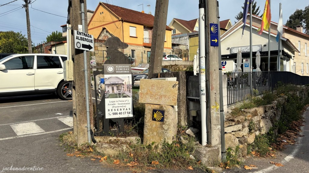
The markers are clearly visible outside the albergue. The narrow tarmac road connects to the busy N-550 and crosses over to the opposite Rua das Lameirinas with a few albergues and cafes. So, I arrived at Arcade- a town known for the impressive Ponte Medieval de Pontesampaio. Sitting at the mouth of the Verdugo River, the town was an important strategic river port for the Romans and they constructed a bridge.
The present bridge is built on a Roman foundation and dates back to the 10th and 11th centuries. A mythical fortress of San Paio de Lodo was situated nearby, the place where the armies of Queen Urraca of Leon and Archbishop Gelmírez fought. The Moors captured and destroyed the fortress in 997. Later, anyone wishing to cross the bridge had to pay a toll, but the practice was abolished thanks to the intervention of archbishop of Santiago de Compostela.
The 144-meter medieval bridge also witnessed a fierce Battle of Pente Sampayo between the Spanish troops and the French army on the 7th and 8th of June 1809. Nearly 20,000 men fought, with an estimated 2,000–3,000 soldiers killed or wounded. The French were forced to retreat and abandon Galicia.
After leaving the ancient bridge, the path leads through ancient houses up a steep and narrow road lined with corn cribs. The trail weaves through a rural path, followed by the original Roman Road. It tends to get busier after Redonlela with more pilgrims at the popular rest area and café.
When walking through the forest, there are locals selling snacks and gifts and even offering a sello (stamp). When ascending the hill, a man on a portable food truck sells fresh orange juice, coffee and light refreshment. Many pilgrims took their short break in these two areas, grabbed some snacks and sipped coffee or juice before continuing their walk. A few members of the Filipino group and I crossed paths once again when I was leaving the rest area.
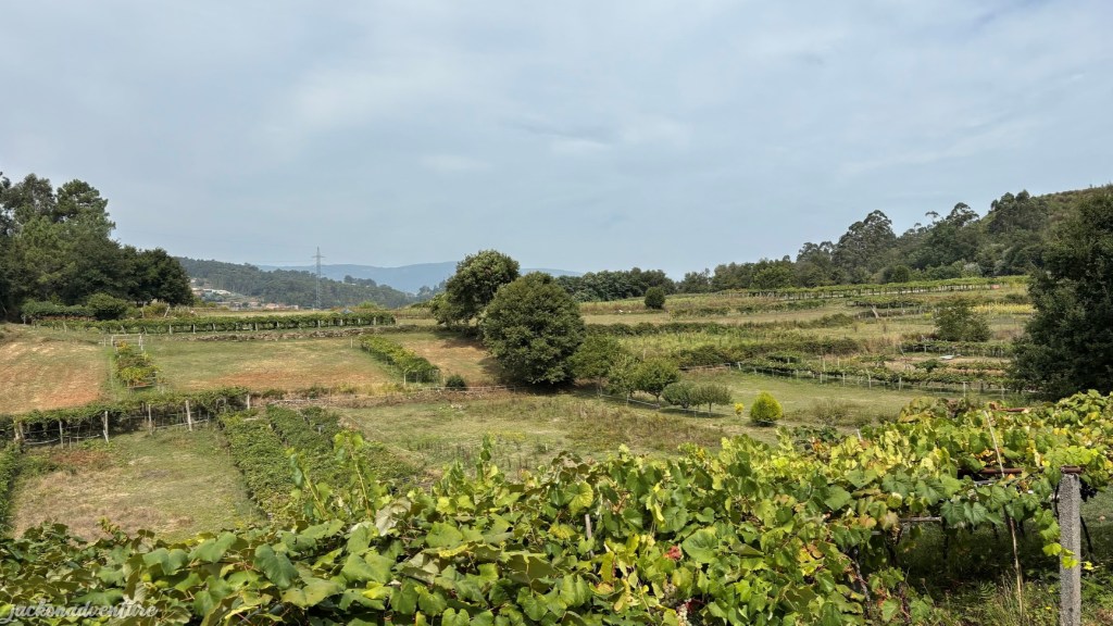
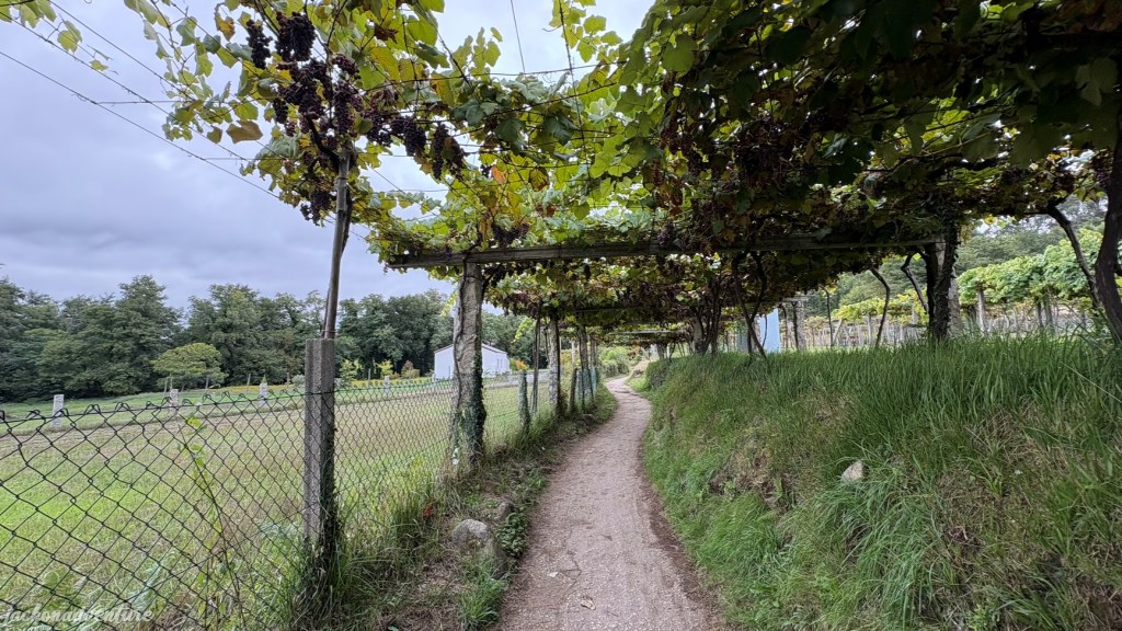
It didn’t take long before getting out of the woods and descending to a bridge that crossed to grape and corn farms. One of the farm owners put some sweet grapes on a stone marker for pilgrims who passed their gate. I enjoyed the magnificent scenic views of the countryside with a peaceful ambience.
Further down the trail is the Santa Marta de Bértola village. There is a chapel called Capela de Santa Marta that dates back to 1617. Recently restored, it is worth a quick visit and another sello here.
Just 500 meters from the village, the trail took me into the forest again. I began to climb the ancient stone road and marveled at the ingenuity of Roman engineering. The road once connected Seville, Mérida, and Braga to Iria Flavia and Padrón, before eventually diverting to Astorga. My hiking shoes and pole give me some comfort when walking through this challenging terrain with uneven and rocky surfaces.
The path goes along traditional river route and eventually approaches Pontevedra. It is well-marked as I wandered through soft trails, green spaces, a few wooden bridges and a tunnel. The distance with the main road is relatively the same, but the river route offers a more enjoyable experience.
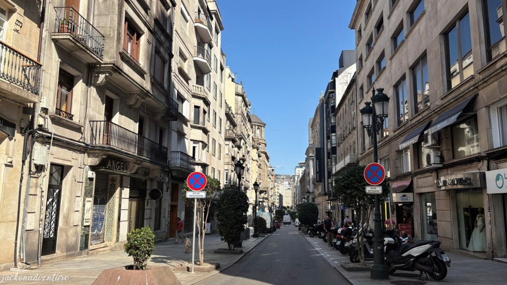
Once passed the train tracks, I’ve finally arrived at the historical Pontevedra city. The city is surrounded by historic buildings, narrow cobbled streets, hidden plazas and a variety of restaurants.
As the second most important historic center in Galllicia, Pontevedra was the largest city in the region during the 16th century. Legend has it that the city was founded by Teucer, hero of the Trojan War. Its history goes back even earlier to the 1st century BCE when the Romans brought the city to life.
In 1169, King Ferdinand II granted Pontevedra a charter, recognising its importance as a trading port. The city continued to flourish and modernise, yet still preserving its medieval and contemporary architecture. The historic centre was declared a historic-artistic complex in 1951.
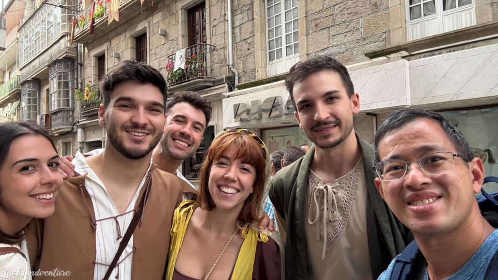
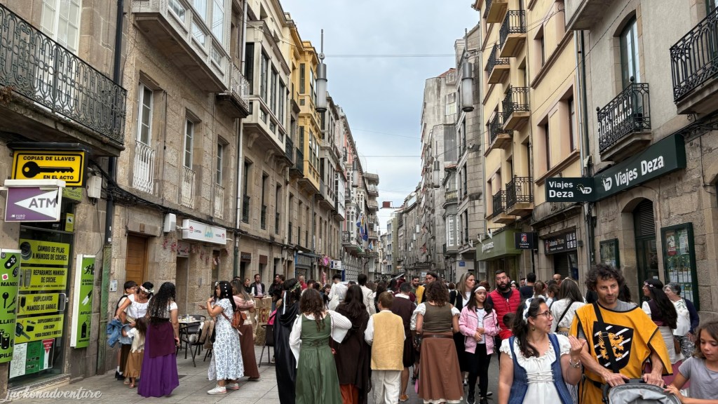
I was so lucky to be there on the first weekend of September when the city hosted the Pontevedra Feira Franca. The tradition dates back to 1467, when the privilege was granted to the city by King Henry IV of Castile to hold a tax-free market for a month. The celebration took place 15 days before and 15 days after August 24 in honour of Saint Bartholomew. The people gathered to celebrate the joyful event regardless of their social classes.
The traditional medieval festival was brought back to life in 2000. The city streets are decorated with colorful banners, pennants and coats of arms to host numerous lunches and dinners. The locals are beautifully dressed in medieval-themed costumes as they roam the city to join the falconry shows, medieval tournaments, concerts and street entertainment. The medieval markets, food stalls and workshops were set up to sell leather, crafts, handmade jewelry, textiles and natural products.
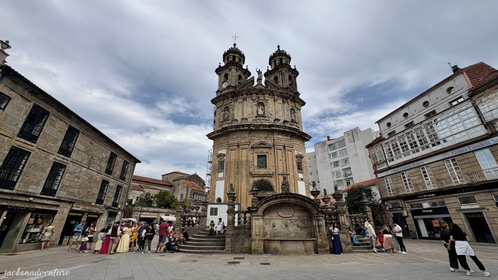
I also visited the incredible Igrexa da Virxe Peregrina that was built in 1792 in Baroque and neo-classical style. This Roman Catholic chapel is dedicated to the Virgin for guidance and blessings to pilgrims on the Camino de Santiago. It houses the image of “La Peregrina,” patron of the province of Pontevedra and the Portuguese Way. The shape of its floor plan is inspired by a scallop shell, the characteristic symbol of pilgrims. I received a sello at the entrance of the church.
Day 4: Pontevedra to Caldas de Reis (21.05 km)
(Pontevedra – San Caetano – San Amaro -A Seca – Caldas de Reis)
Elevation Gain: 290.15 meters/ Elevation Loss: 289.28 meters
Before saying goodbye to Pontevedra, I had breakfast at one of the cafeterias in the city center. Many pastry shops are open at 7 am in big cities or small towns along the pilgrimage trail. I didn’t have any issues looking at food in the morning so far.
Today is one of those days with gloomy weather. Don’t expect to have bright sunny days and clear blue skies every day. Before venturing on the Camino walk, I suited up with my pancho, which covered all the way to my shin.
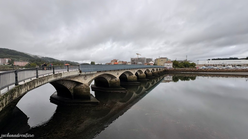
I continued the way down to the riverbank of Río Lérez and joined the other pilgrims and walkers. The yellow arrows are easy to spot as they guided me out of the town and crossed the medieval Puente del Burgo.
The bridge was originally built during Roman times when Pontevedra was known as Turoqua. It fell into disrepair over time, but was rebuilt during medieval times in the 12th century under Alfonso VII’s reign. Crossing this bridge became so meaningful as part of the Portuguese Way route.
The path out of Pontevedra takes me from the city to the suburbs and then gradually moves into quieter countryside. Most paths are tarmac roads and not trails, and they can be narrow in places and without pavements. Extra caution is necessary because vehicles pass through the road.
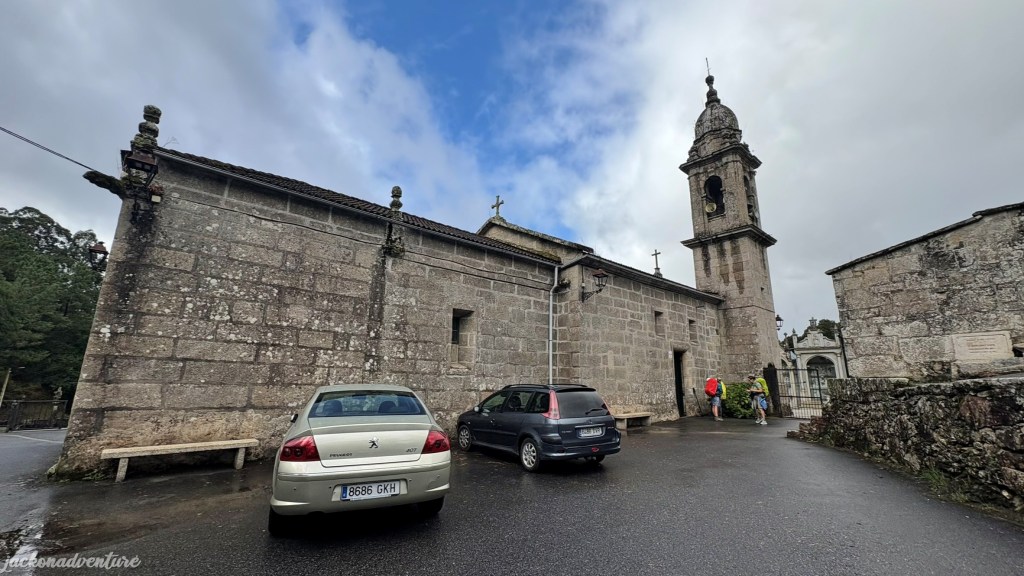
The first church that I came across today was Iglesia Santa Maria Alba. It may seem like an ordinary church along the Camino Português. The current structure dates to the 18th century, but its history goes back to the Middle Ages. An epigraph carved into a single stone near the bell tower indicates a more ancient past.
A little further down the road is the Cruceiro de Santa María de Alba, one of the many Galician stone crosses. These cruceiros are often found at crossroads, churchyards, or other prominent locations. They act as markers of faith, offering protection to travelers and serving as waypoints; probably the Medieval version of our yellow arrows.
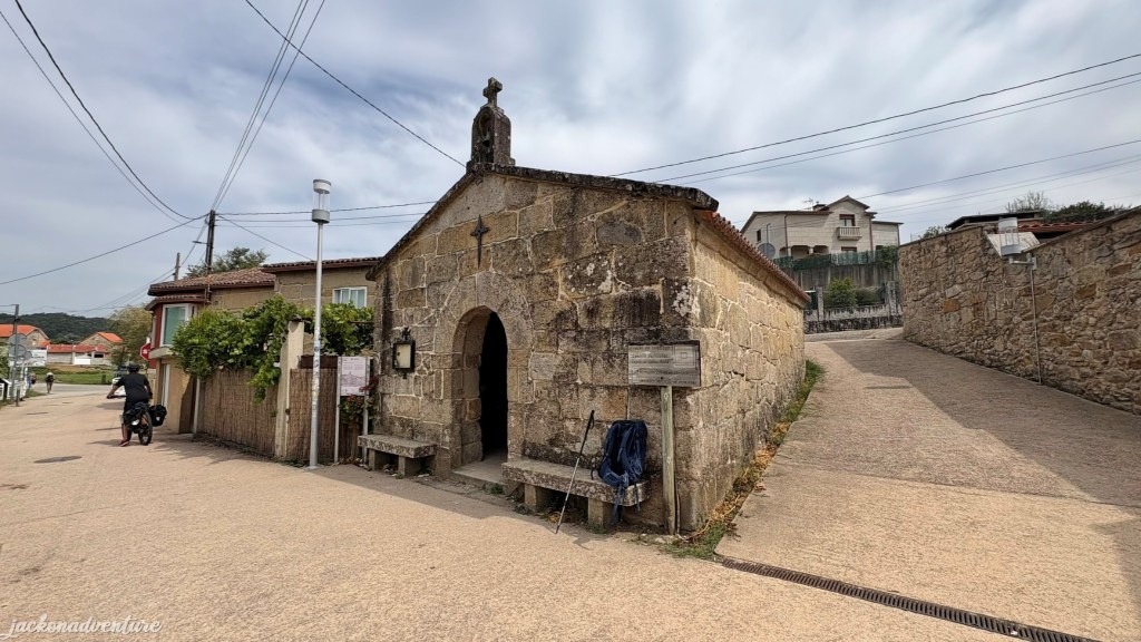
The trail later leads to the countryside along PO-225, and there is a pathway for pilgrims to walk. Soon, I arrived at the tiny village of San Caetano. It was named after Saint Cajetan, the patron saint of job seekers and gamblers. The Baroque-style Capilla de San Cayetano is likely built after 1671, the year of his canonization.


When I was leaving the chapel, I met an Australian hiker from Melbourne, Kim, who shared something in common like me. She was also participating in the “Dual Pilgrim” and completed the hike in Komodo Kodo in May 2024. What a small world!
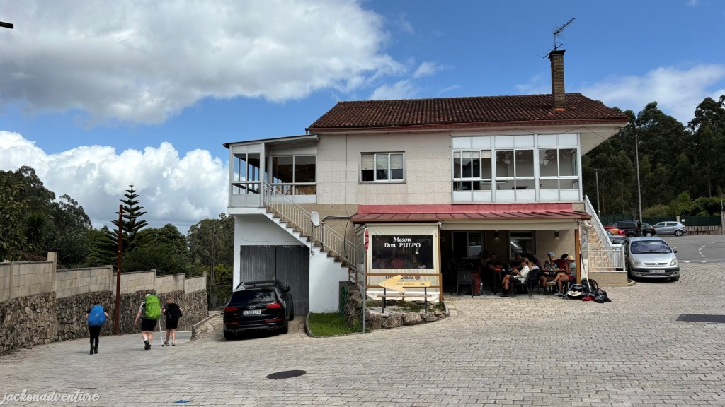
The journey goes through a mix of tarmac roads and forest trails and crosses the train tracks. It’s often to come across several stone footbridges. The 4.3-kilometer hike leads to San Amaro village, which a popular rest stop for pilgrims and hikers. The village is very small with a nice bar called Meson Don Pulpo that tends to be busy serving the hungry pilgrims. Many people replenish water and snacks in this bar.
The tiny Capilla de San Amaro de Barro located opposite the bar, is hard to miss. Many travelers stopped to visit this chapel before departing the village.
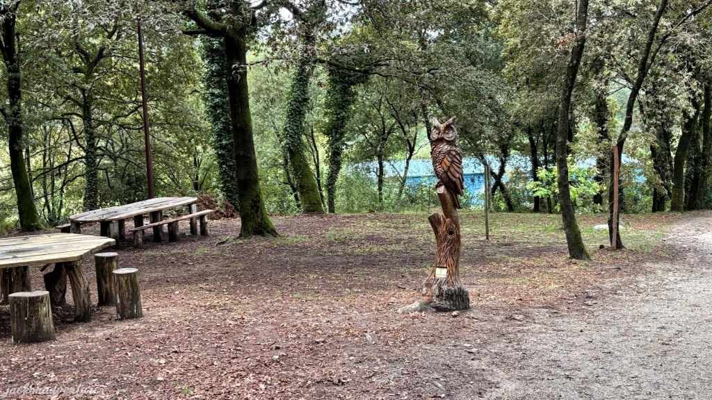
There is a stone marker that indicates 57.5 kilometers to Santiago on the street next to the bar. The yellow arrows guided me to the safe paths to huke before venturing into the forest trail. A short descent goes to the historical Carballeira con Esculturas de Madeira (above), a picnic area with a statue of a pilgrim, a scallop shell and an owl.
The sections of the trails on San Antonino are mostly flat and the locals grow vegetables and grapes in their house compounds. As I was walking along the pilgrim’s path next to N-550, my knees and ankles started to feel some discomfort. Once I reached A Seca town, I managed to seek help from a couple who owns a café along the N-550. They are truly my saviour for the day because they helped to call a taxi driver to take me to Caldas de Reis.
After skipping the last 6 kilometers, the driver dropped me off at the taxi stand near the imposing Igrexa de San Tomé Becket. At first glance, Caldas de Reis might look like a quiet town along the Camino Portuguese. However, the history of the town tells a different story. Several burial mounds and petroglyphs were discovered here, dating back to the megalithic age around 4000 BCE.
During the Bronze Age (1800-1500 BCE), the region was home to the AS Silgadas Treasure, a spectacular hoard of gold jewellery considered the largest collection of Bronze Age gold in Europe. Hill forts were built during the Iron Age between the 7th to 1st centuries BCE. During the mid-1st century CE, the Romans built the Via XIX, one of their most important ancient roads. They named the town Aquis Celenis or Aquae Celenae, in homage to its thermal waters.
Caldas de Reis retained its influence after the fall of the Roman Empire. By the 12th century, the town gained new significance as the birthplace of royalty, including Alfonso VII, the King of Castile.
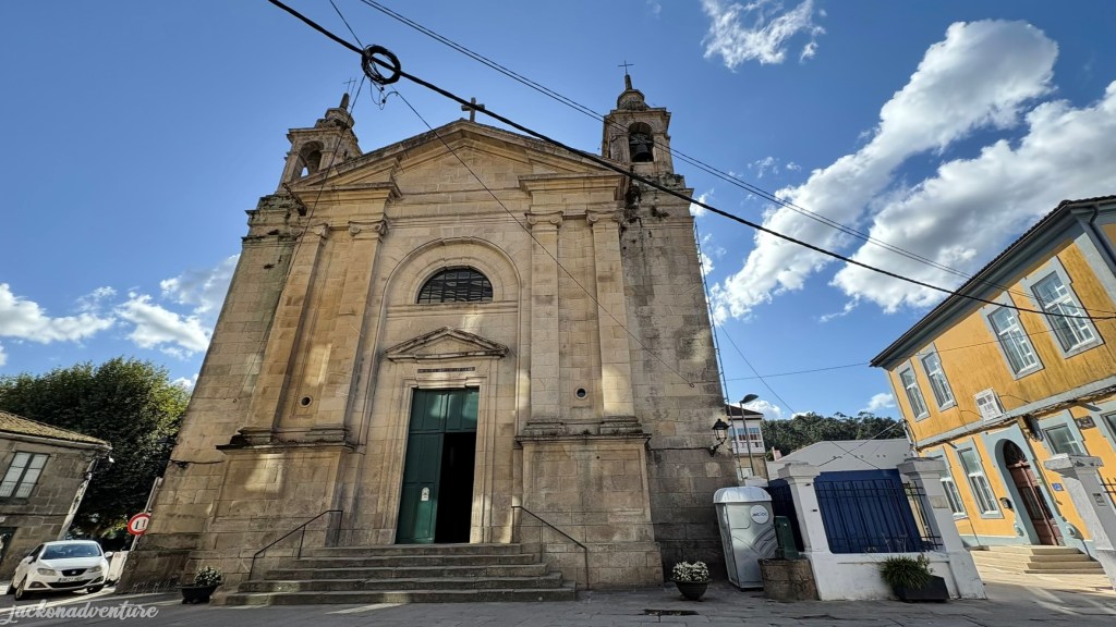
Igrexa de San Tomé Becket is one of the charming churches in town. Dating back to the late 19th century, the church Is dedicated to Archbishop Sir Thomas Becket. It was built between 1890 and 1894 with the remains of the medieval towers of Queen Urraca, where King Alfonso VII of Castile and Leon was born. The archbishop completed the pilgrimage from Portugal in 1167 and stopped in Caldas.
Day 5: Caldas de Reis to Padrón (19.2 km)
(Caldas de Reis – Carracedo – Cortiñas – San Miguel de Valga – Padrón)
Elevation Gain: 340.94 meters/ Elevation Loss: 370.47 meters
Today’s long hike takes me into the lush green Galician woodlands, country lanes and rural villages. The journey began at Calle Real, the Royal Road to Santiago. There are yellow arrows that pinpoint the directions onto the Camino walk throughout the town.
The route crosses the ancient Ponte romana do río Bermaña, a significant crossing points since Roman era. The present version dates from the 16th century, believed to have been reconstructed over the original Roman foundations.
Walking in a steady pace, the path passes through a quiet country road that eventually gives way to forest trails and corn fields. For the most part, the trail is mostly tarmac with light traffic and one section is covered with cobbled stones along the corn fields.

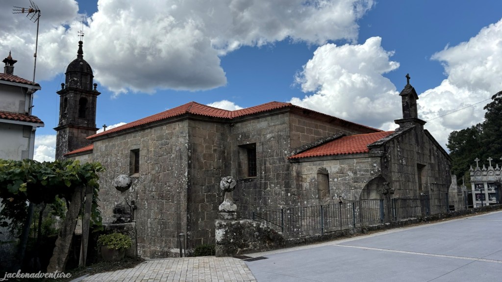
The trail gives way to Carracedo town, where the Church of Saint Marina of Carracedo was spotted from a short distance. Unfortunately, the 12th-century church in Romanesque style isn’t open for visitors, but can admire it from outside. It is surrounded by enormous palm trees and some wooden sculptures within its compound.
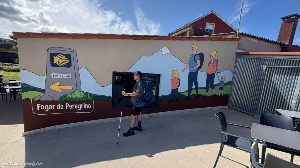
The route from the forest trail eventually comes to the busy intersection of N-550, carefully crossing to the other side of the road to reach Casalderrique town. It is a perfect stop at Fogar do Peregrino to have lunch and catch a much-needed break. This pilgrim cafe serves simple and affordable meals and is usually busy with pilgrims. There is a nice painting outside the café worth a photoshoot.
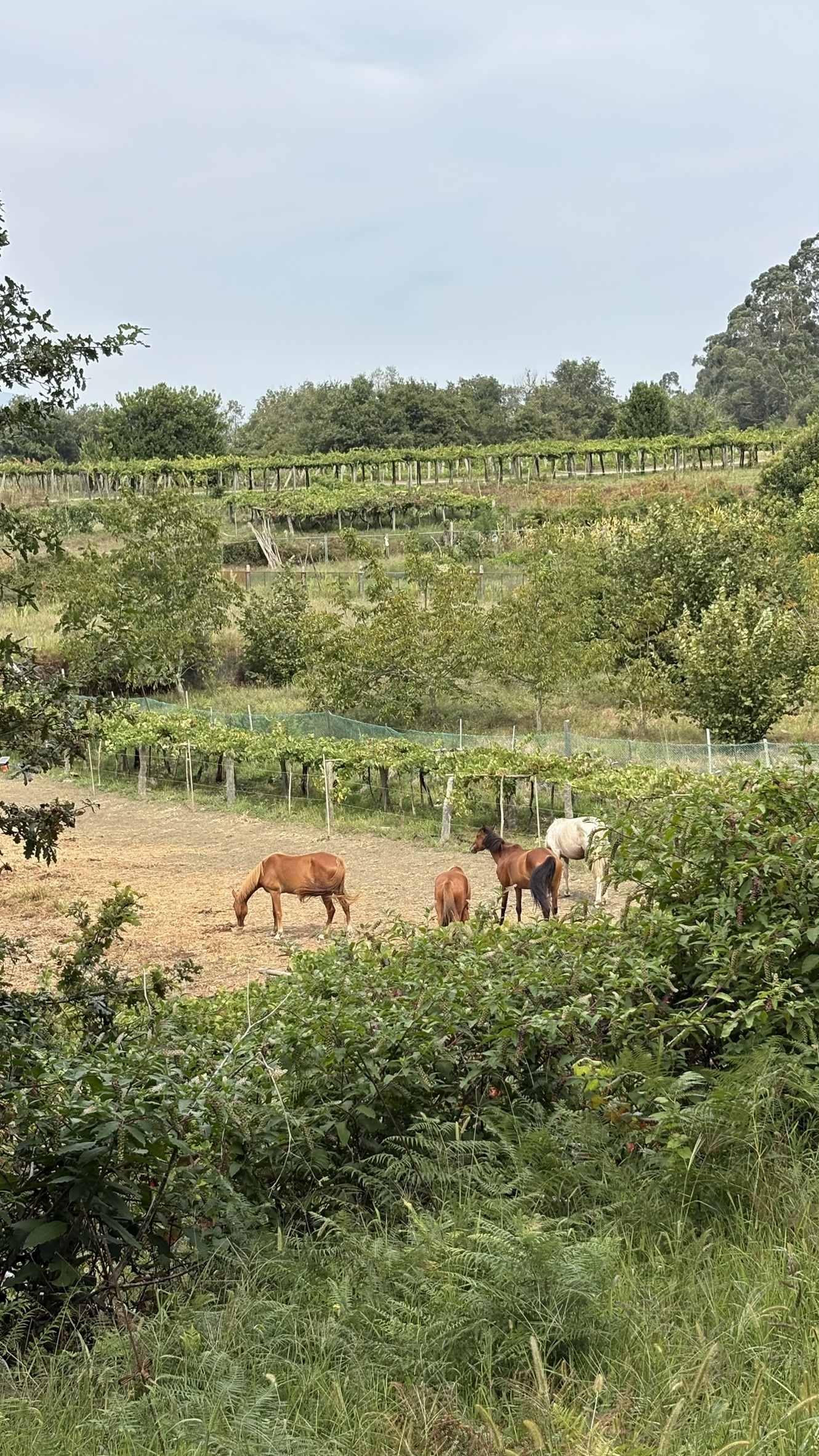
After refreshing myself, I continued walking along the Chemin de Randonnée, passing some farmlands, believed to be the breeding ground for horses. The horses roam freely around the compound. There is a bridge above Highway E1 to cross over to the other side. The pathway is rather easy to walk, but often faced under the hot sun and the humidity of the weather.
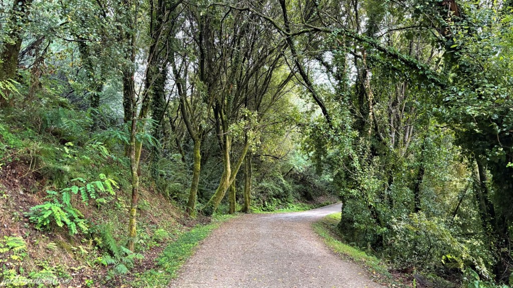
The trail passes through O Pino village and goes back into the green tunnels of trees. The path is well-maintained and poses no significant challenges. Since there are fewer pilgrims along the section, I get to savour an hour of peace and solitude, and enjoy the serenity of the green forest.
Soon, the forest trail leads me to San Miguel de Valga, a part of the wider Valga municipality. This area is rich in history, with evidence of human civilization dating back to the Bronze Age. Artifacts such as the Camporredondo petroglyph were found here.
The Celtic tribes lived here between the 6th century BC and the 2nd century AD, with fortifications and settlements built in these lands. The Romans also constructed roads like the Via XIX, which pilgrims walked along from Redonlela to Pontevedra.
There is a church named Iglesia de San Miguel de Valga, built in the 18th century. It is likely built over the older foundation. The village offers two excellent cafes called Cafe Buen Camino and Cafe Bar San Miguel.
Before reaching Padrón, the path crosses over the Puente Romano de Pontecesuras. It marks the entrance to Padrón and spans the Ulla River, connecting the provinces of Pontevedra and A Coruña. The current structure dates to the 12th century and is believed to be built on the site of an earlier Roman bridge.
Padrón is perhaps the most significant and only town directly tied to the ministry of Saint James on the Iberian Peninsula. The town was historically known as Iria Flavia, a Celtic settlement located at the confluence of the Sar and Ulla Rivers. When the Romans occupied in the 1st century AD, they renamed it Iria Flavia during the rule of Emperor Titus Flavius Vespasianus.
It is said that Saint James the Greater (Santiago el Mayor), lived and preached here during his missionary to the Iberian Peninsula. Although there is little evidence to confirm his presence, the enduring history that has been passed down for centuries tells that he has lived and spread the word of Jesus in Padrón and the nearby Mount Medoñas. His mission has brought little influence among the local community, but his efforts became the foundation of the region’s Christian story.
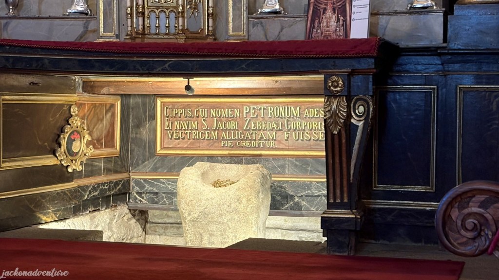
After his martyrdom in Jerusalem in 44 AD, his disciples are said to have transported his body back here. They moored their vessel to a large stone, the Pedrón, which is now housed under the altar of the Church of Santiago de Pedrón. The altar gives its name to the town.
When I was searching for my accommodation, a voice that sounded familiar was heard from behind calling my name. They were Bob and Jenny, whom we met on the first day at Praia de Patos. I was surprised that they remembered to get a scallop shell for me to hang behind my backpack.
We had dinner together at Restaurante O Santiaguiño and shared our Camino adventure over the past five days. Bob (and Jenny), who come from a Catholic family, have taught me about their faith and beliefs. I was thankful to learn from his sharing and get a better understanding about Christianity and the reason why many people embark on the Camino journey.
That evening, I explored the narrow cobblestone streets and visited Iglesia de Santiago, known as the Church of Saint James. The first construction of the church dates back to the 10th century, situated a few meters from the bank of the River Sar. According to Jacobean tradition, the disciples Theodore and Athanasius transported the Apostle during the Traslatio from Palestine to Gallicia on a ship and moored here.
The most notable feature of this church is the Roman altar located beneath the main altar. The town was named after this altar called Pedrón, and it is where the ship carrying the disciples was moored. Originally, this altar was built by the Romans as a tribute to the god Neptune. As time passed, Christianity reinterpreted it as a port element. There is a small inscription that interprets as “To Neptune, the Iriense forum with its money.”

Perched at the top of a small hill is the Convento do Carmen, that was inaugurated in 1752 with its religious community. The convent belonged to the Barefoot Carmelites until the 20th century and it was passed into the hands of the Dominicans. Again, it isn’t open for people to visit.
Unfortunately, I didn’t get to see Santiaguiño do Monte because the sun was almost setting. It is a short hike to the site with a chapel and a stone cross, which is said to be where Saint James preached.
Day 6: Padrón to O Milladouro (17.7 km)
(Padrón – Iria Flavia – A Escravitude – A Picaraña – O Milladouro)
Elevation Gain: 369.69 meters/ Elevation Loss: 132.59 meters
Today, every pilgrim on the Camino Portugués will depart from Padrón and take the same path to Santiago. Most people will complete the last 25 kilometers in one day. However, others like me will break down the walk into two days.
Nevertheless, all pilgrims who walked from Lisbon, Porto, Nigran, Vigo or Tui, or whether they took the Coastal or Central route, will take the same route to Santiago. The path isn’t easy. Not only is the walk long, but there are also hills to climb, and the forest tracks can become muddy if it rains.
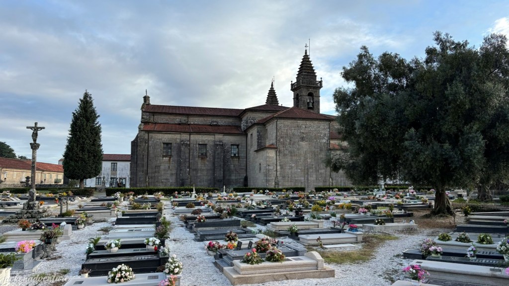
In less than 1 kilometer is the Igrexa de Santa Maria de Iria Flavia. The church is considered to be the first Marian church in the world and one of the oldest churches in Galicia. It used to be an episcopal see. The church’s Cementerio de Adina has an extensive collection of well-preserved sarcophagi and tombstones, and it is said that 28 bishops have been buried here. The Nobel Prize winner for Literature, Camilo José Cela, was also laid to rest here.
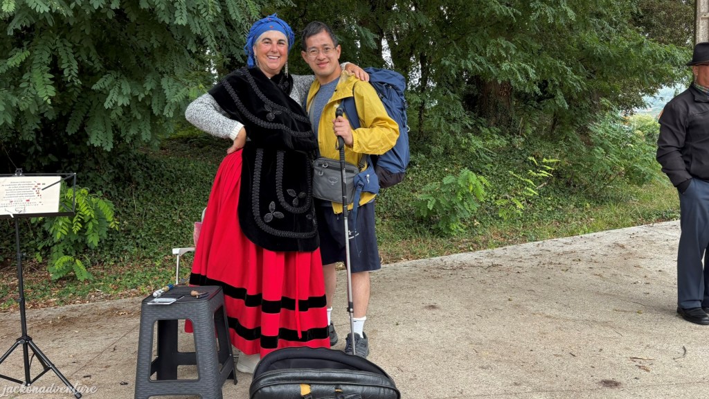
The trail passes through both modern and stone houses, and back to the countryside once again. The stretch of 4.5 kilometers is still pretty easy, walking along the flat path. Pilgrims and hikers are entertained by a lady dressed in traditional Galician clothing sings gracefully while a bagpiper plays wonderful music.
Soon, I reached another small village named A Escravitude and it is home to the Igrexa da Escravitude. According to legend, Juan Pérez Mondragón, the rector of the parish of Cruces, narrowly escaped death when a tree nearly fell on him in 1582. In gratitude, he commissioned a sculpture of the Virgin and Child and placed it above a local fountain. A chapel was built in the late 16th century to house the image.
The church is also known for its miraculous healing waters. In 1732, an ill pilgrim traveling along the Camino was suffering from dropsy and drank from the shrine’s fountain. Then, he sought the Virgin’s help and was cured within 72 hours. Then, he said, “Thank you, Our Lady, for freeing me from the slavery of this disease.” The pilgrim donated a cart and oxen to the sanctuary in his gratitude. It was completed in 1886 and later attracted devotees in search of healing.
The Holy Fountain now sits beneath the stairs leading up to the church from the road.. There is a small café and a souvenir store where I bought some gifts that are slightly cheaper than those sold in Santiago de Compostela.
Departing Escravitude after lunch, I’ll started to feel the ascending path all the way to Santiago. The climb is gentle for the most part. The yellow arrows guide pilgrims from busy roads and under the railway line whenever possible, especially along N-550.
The trail leads to a small town of A Picaraña and there is a café named Café A Milagrosa, often busy with pilgrims. After crossing the busy N-550, the arrows guided me back to the quiet paths through the forest and a traditional pilgrim stay called Albergue de Peregrinos de Faramello. There are several small hamlets along Rua de Francos and Casalonga. These narrow streets are lined with traditional Galician houses and tiny cafés.
The walk of the day ended at O Milladouro, where it seems like a modern city compared to the villages just passed. The Capilla de Santa Maria Magdalena in the city is believed to have been established between the 10th and 11th centuries. The modest stone structure has long served as a waypoint for pilgrims closing to the end of their journey.
A night was spent here at the popular Albergue Milladouro, a cozy albergue well equipped with comfortable bunk beds, clean toilets, a lovely common area and a big dining area. There is a cafés next door, which serves burgers, fried chicken and beer.
Day 7: O Milladoiro to Santiago de Compostela (7.7 km)
(O Milladoiro – Porto de Conxo – A Rocha Vella – Santiago)
Elevation Gain: 142.37 meters/ Elevation Loss: 140.81 meters
Today started early on my last day of the Camino walk to Santiago de Compostela. As the trail gradually reached the urban outskirts, it offered a little twist of greener paths from my alburgue along Rua das Espinas. The trees give a little protection against the morning’s drizzle and the temperature has slightly dropped.
Santiago seems to be closer, but it’s still a fair distance to hike before spotting the spires of the Cathedral. I have learnt that the name O Milladoiro is thought to originate from the Galician word miradoiro, meaning viewpoint, or from the Latin word ‘humilatorium’, which refers to a place where pilgrims would humble themselves upon catching the first glimpse of the Cathedral’s spires.
As the journey soon comes to an end, a mix of emotions comes rushing onto me. I felt happy and couldn’t believe that I had made it this far for 112 kilometers. Yet, there is a little sadness because I have the remaining 7 kilometers to walk before concluding the walk to Santiago. It has been very exhausting to conquer the hills and long forest trails.
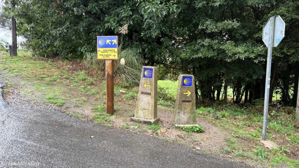
The trail heads back to the tarmac roads as it passes under a flyover and crosses the historic Puente Vella de Arriba. After walking down the slope, it goes along Rua da Voltado Castro de Abaixo, where there are two stone markers that offer two choices of route in Bifurcacion. One waymark says “Por Santa Marta,” to the left and the other “Por Conxo,” to the right.
The reason I have chosen the trail via Conxo is because, in my opinion, it is more beautiful. The route adds an extra 400 meters to Conxo, and it passes through the spectacular Igrexa da Nosa Señora da Mercé de Conxo. The 18th-century church dates back to the time of Archbishop Diego Xelmírez, who intended to house a community of nuns. It currently houses the well-known Provincial Psychiatric Hospital.
According to tradition, the site was founded by Mrs. Rusuida to provide a decent burial for her husband, Almerico Canogio. He was murdered during his pilgrimage to SAntiago. She spent all her money to build the church and named it Santa Maria de Canogio (Conxo).
Cautionly cross the highway on crosswalks near the church and walk toward the narrow Rúa de Sánchez Freire street. The 2.25 km marker is spotted afterwards. After crossing the Praza de Vigo, the Conxo route merges with the Santa Marta route and the trail continues to climb towards Santiago.

When entering the city center, the walk passes the expansive Parque da Alameda and into a plaza filled with café tables. I continued through the traditional pilgrim gate, the Porta Faxeira, but it was historically called the Porta de Falgueris.
With just a mere step from the cathedral, its spire can be seen from Plaza Franco. I kept on walking through the narrow streets lined with restaurants, bars and souvenir stores. Other pilgrims and I were cheered by passersby when we were so close to the Cathedral
Eventually, I came to Obradoiro Square.
And there it is- the magnificent Santiago de Compostela!


I felt overjoyed for accomplishing my amazing Camino Portugués over the past week. I sit on the square to admire this stunning Cathedral and rest my tired feet. I met the father and daughter duo from Texas, and celebrated our victory together.
When it started to rain again, I made my way to the Pilgrim Office to get my last stamp of the Santiago de Compostela Cathedral. I was greeted by the friendly staff, who later prepared the Compostela certificate. It is a traditional religious certificate issued in Latin by the Church to verify the completion of the minimum distance for spiritual or religious reasons.
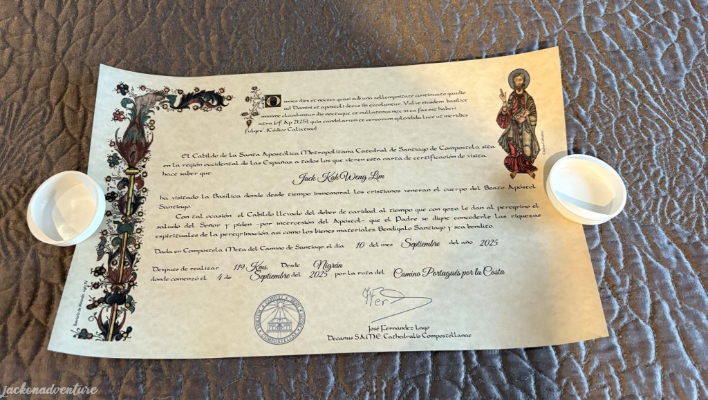
Historically, it replaced the scallop shell as official proof. During the Middle Ages, the Compostela served as evidence of penance and a symbolic ‘ticket to heaven.’ I happily accepted my certificate that shows my completion of a 119-kilometer walk for spiritual reasons. Later, I visited the Turismo de Santiago Information Center to obtain my “Dual Pilgrim” certificate as well.
Self-Reflection on the Camino
Walking the Camino Portugués Coastal Route is truly a once-in-a-lifetime experience. After hiking 119 kilometers over the past 1 week, the journey concludes with a day of celebration but also a day of closure.
I’m glad to meet many pilgrims and hikers from all over the world. We have shared many stories about the Camino journey and learning the culture and beliefs of Christianity. During the times of difficulty, there is always someone there to help and give encouragement
For many pilgrims, it’s a deep spiritual experience. As for me, I walked the Camino to embrace myself through physical challenge. If someday I choose to walk the Camino again, I would hike the Camino Portugués Central Route or the Camino Francés.
Going Elsewhere in Spain?
If you are looking for more adventure in Spain, you can look at my other posts for a travel guide:
- Santiago de Compostela
- Madrid
- Toledo
- Seville
- Córdoba
- Málaga
- Barcelona
- Travel in Renfe Train
- Spanish Gastronomy
Like It? Pin This Article.


Leave a comment